
About
City Lake Maps and Charts is a hydrography and cartography project focusing on the unique beauty of our city lakes and parks. Our inaugural production is a NOAA-style navigational chart of the four interconnected lakes in southwest Minneapolis, part of the Minneapolis Chain of Lakes. The area includes Lake Calhoun, Lake of The Isles, Cedar Lake, and Brownie Lake.
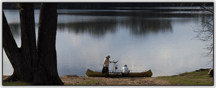
The hydrography was performed by City Lake Maps and Charts using differential GPS and high quality sonographic logging equipment in the spring of 2011. It represents the most up-to-date depth contour data available today. We are not professional hydrography service, so these charts should not be used for critical navigation or marine survey purposes.
We hope you enjoy the chart and the lakes that inspired it!